Laser Scanning For Industrial MEP, Water Treatment, Petrochemical, Oil & Gas
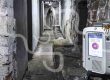
Laser scanning has been proven extremely helpful within large industrial sites. Often large, complex sites with pipes, tanks and support structures that are almost impossible to survey using traditional methods. High quality laser scanners such as the Leica P40 along with survey control can be used to create high quality, accurate point clouds of sites. These point clouds can be modelled in various software such as Leica Cyclone Model, Edgwise, Revit, AVEVA.
Once the data is in the software suite of choice it can be modelled directly from the point cloud. This gives the user an as built model off all the pipes, tanks and structures that were surveyed. The model & point cloud can then be used for retrofitting, redesign and clash detection. As well as an asset register of as built conditions.
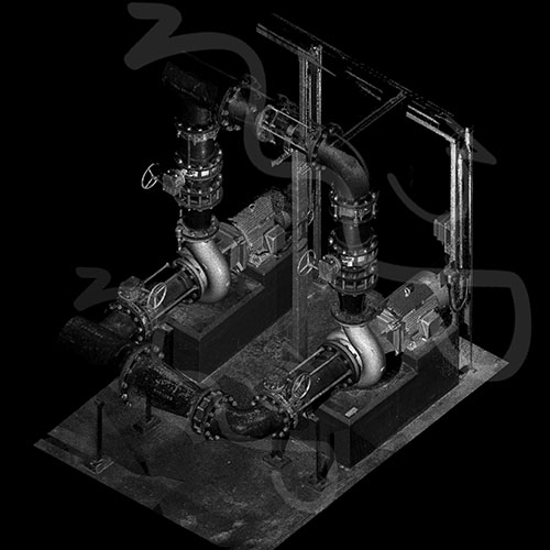
3D Laser Scanning For Pipes – Industrial Site Laser Scanning (full resolution image here – www.flickr.com/
Laser Scanning Services By M3S Surveys Ltd
The M3S team have spent years using and improving our work flows for laser scanning & measured surveying. From on site, registration software, QC to production for plans, elevations, cross sections, topo and Revit models. In addition to these products the laser scanning data can also be used for the following:
- Point Cloud (view / import to 3rd party software)
- Jet Stream Viewer (desktop viewer that allows the client to visit the site and each scan location with the ability to measure etc)
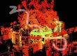
- Ortho from Point Cloud (high resolution ortho image can be generated and underlaid in CAD)
- LGS (a Leica Geosystems file that can be used in Jet Stream and CloudWorx)
The video below is a screen recording from point cloud data (LGS format) in the free to use Leica Jet Stream viewer. It can be used on your local machine or hosted online* (depending on data size this can be costly).
Desk Top Site Visit – Jet Stream Viewer
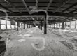
Revit Model From Point Cloud – Laser Scanning & Measured Surveying
Once of the products that be produced from the successful data capture from laser scanning is a Revit model. This is produced from modeling the point cloud. The following video shows what can be produced:
Measured Building Survey – 3D Laser Scanning For Revit Model
Surveying Services
Terrestrial Laser Scanning (TLS) – https://www.m3s-surveys.com/services/terrestrial-laser-scanning/
Building Surveys (MBS) – https://www.m3s-surveys.com/services/measured-building-surveys/
Topographic Surveys – https://www.m3s-surveys.com/services/topographic-surveys/
Photogrammetry – https://www.m3s-surveys.com/services/photogrammetry/
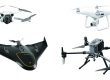
Aerial Surveys – https://www.m3s-surveys.com/services/aerial-surveys/
Spatial Data Analysis & Processing – https://www.m3s-surveys.com/services/spatial-data-analysis-processing/
Links:
3D Revit Model – https://www.autodesk.co.uk/products/revit/overview?plc=RVT&term=1-YEAR&support=ADVANCED&quantity=1
Leica P40 Laser Scanner – https://leica-geosystems.com/en-gb/products/laser-scanners/scanners/leica-scanstation-p40–p30
2D Cad Drawing – https://www.autodesk.co.uk/products/autocad/overview?plc=ACDIST&term=1-YEAR&support=ADVANCED&quantity=1