Laser Scanning Specialist For Scan2BIM / Reality Capture & High Quality Revit Models

We are a team of skilled and experienced individuals with expertise in areas of Land & Building Surveying, Laser Scanning, Photogrammetry, Architecture and Project Management.

With a range of tools and techniques at our disposal the team at M3S Surveys is ready to help deliver your next project.

Our Latest Projects Include:
  • As-built surveys
  • Scan2BIM
  • Topographic surveys for planning applications
  • Revit modelling – BIM
  • CAD drawing – 2D Plans and Sections
High Quality Standards
A wide range of professional qualifications including RICS and The Survey School, combined with academic degrees and our Management System means we maintain high standards throughout the project life-cycle.
Qualified & Experienced Team
Years of project experience together with an in-depth expertise founded on solid academic knowledge makes our team ready to advise on best way forward with your next survey.
Global Project Experience
The M3S team has a wealth of experience from around the world. We have been carrying out projects in the  USA, UAE, India, Italy, Netherlands, Portugal, Poland, Scotland, England, Wales & Ireland.
Research & Development
Continuous efforts in finding better and quicker ways to deliver your next project without sacrificing the quality of your data are just part of our regular day.

Services

Leica P40 Laser Scanner

Terrestrial Laser Scanning (TLS)

Accurate and complete point clouds in any file format. Spatial information stored with intensity and colour values.

Total Station Land Survey

Topographic Surveys

Traditional outputs produced using latest technologies such as Robotic Total Stations, Digital Levels, GNSS Receivers, Laser Scanners and more.

Measured Building Survey

Building Surveys (MBS)

Detailed building surveys carried out before, during or after construction to produce 2D plans, sections and 3D models.

Aerial Surveys

Aerial Surveys

Processing aerial data such as imagery and LiDAR as well as carrying out low level surveys with Fixed Wing and Multi Rotor UAV’s.

ArcGIS

Spatial Data Analysis & Processing

Analysis and transformation of existing datasets to meet new standards or to work on modern management systems.

Photogrammetry Phase One Medium Format Camera

Photogrammetry

Image based metric survey carried out using traditional – stereoscopic approach and modern techniques such as structure from motion (SfM)

Popular Products

CAD

CAD

Topographical and architectural plans in 2D and 3D
BIM - 3D & REVIT Models

BIM

Parametric 3D model of an existing building
Leica TruView

Leica TruViews

Panoramic image of a project point cloud with additional functionality
High Resolution Ortho Photo

Orthophoto

Fully metric, rectified photograph of an object

Academic & Professional Qualifications Alongside Years of Work Experience

M3S Surveys is made of a team of people with talent and expertise in various areas of Geomatics. Sound knowledge of geodesy and cartography lays a solid foundation for services which M3S is offering to their customers. Our crew comprises of surveyors, photogrammetrists, GIS experts, cartographers, architects and urban planners. This environment creates a melting pot of skills ready to be utilised in many spatial projects.

Laser Scanning USA

Why M3S Surveys Limited?

  • We have solid academic and professional qualifications
  • We have an enthusiastic team with at least 10 years work experience behind each member
  • We use industry leading technology to deliver your project

More information on our About Us Page – Click Here

Latest Blog Posts

As Built SurveyBlogLand SurveyingLaser ScanningLaser Scanning PolandLeica GeosystemsLeica RTC360MEP (Mechanical, Electrical, and Plumbing) Measured Building Surveys Poland

Measured Building Surveys Poland

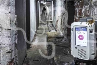
Measured Building Surveys Poland   Measured Building Surveys Poland – our scanning teams to access some rather interesting and spooky places. With basements, attics to abandoned factories the team at M3S have all enjoyed exploring these areas while scanning to allow for a complete survey to aid the creation of plans and models.   Measured…
Read more