Leica Cyclone REGISTER 360 Version 2021.1.2
Leica Cyclone REGISTER 360 Version 2021.1.2 is the most recent release from Leica GeoSystems point cloud registration software – the M3S Surveys team have been using the original Cyclone Core software for the last 8 years. Due to the recent addition to our scanner fleet of a Leica RTC360 we have been trying out Reigster 360 with the RTC360 data when using the VIS feature before importing the project into Cyclone Core for final registration and QC checks.
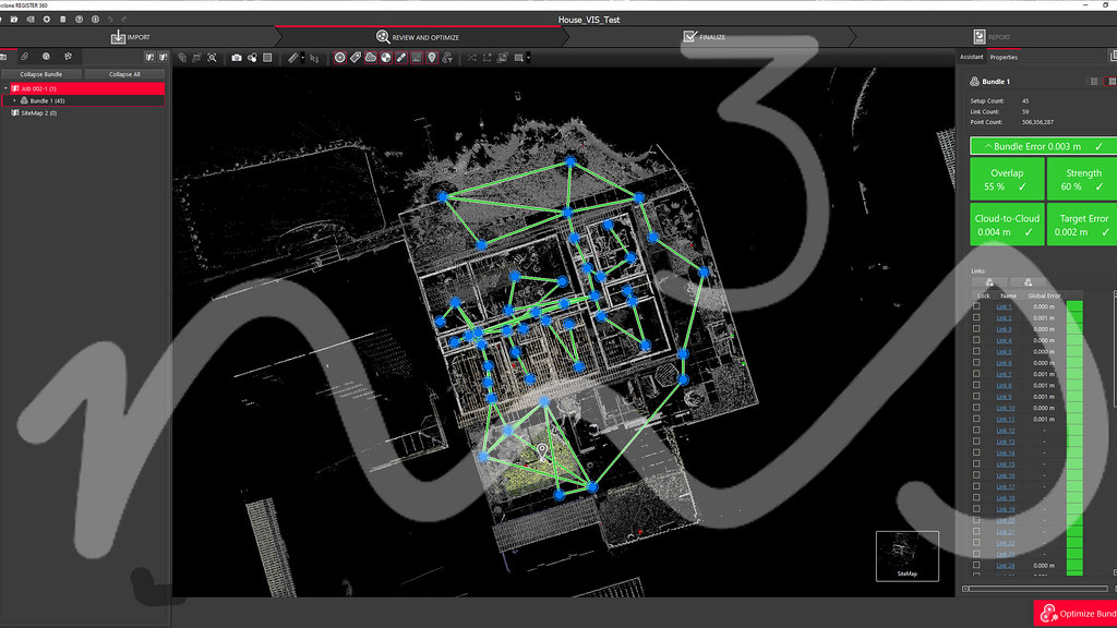
Registration in Leica Cyclone Reg 360
There are quite a few differences between the packages and for those of us set in our ways of using Cyclone Core its hard to get use to the more visual interface of Reg360.
Cyclone Register 360
Using VIS allows for the scans to be placed in the correct location before applying additional registration techniques and QC.
Reg360
Cyclone Core
More information can be found on the official Leica Geosystems website – click here
M3S Surveys Ltd – Laser Scanning, CAD, REVIT, Surveying and Photogrammetry Services:
Terrestrial Laser Scanning (TLS) – https://www.m3s-surveys.com/services/terrestrial-laser-scanning/
Building Surveys (MBS) – https://www.m3s-surveys.com/services/measured-building-surveys/
Topographic Surveys – https://www.m3s-surveys.com/services/topographic-surveys/
Photogrammetry – https://www.m3s-surveys.com/services/photogrammetry/
Aerial Surveys – https://www.m3s-surveys.com/services/aerial-surveys/
Spatial Data Analysis & Processing – https://www.m3s-surveys.com/services/spatial-data-analysis-processing/