Measured Surveys In Poland
M3S Surveys have been involved in carrying out measured surveys in Poland over the last 5 years. These range from residential property, hotels to large historical sites in cities including Kraków, Warsaw, Gdańsk, Katowice, Wrocław, Łódź and Kielce plus many smaller towns and rural areas. Our primary method of survey is via laser scanning. This allows the team to collect large amounts of data to create a point cloud. From the point cloud the M3S team can create measured survey drawings and 3D models. Our measured surveys include floor plans, elevations, cross sections and Revit models. Our team that is located in Poland can be on site within short notice. (*Our site is also available in Polish: Polish Language Website – https://www.m3s-surveys.com/pl/strona-glowna/ )
Our clients in Poland and the UK clients also receive TruViews via the Leica LGS format – these can viewed with a free piece of software from Leica Geosystems called TruView Viewer (PC only). This allows each scan station on site to be visited from your desktop, mark up and take measurements along with the ability to insert an IFC file within the LGS point cloud version of the export. A basic example of this can be viewed in the following video:
REVIT

REVIT model created from laser scan data
Point Cloud From Measured Surveys In Poland

Point Clouds

Large scale measured survey – 100+ buildings, out door spaces and plant rooms
CAD Drawings

CAD – 2D elevations and topographical drawings
Topographical Survey

Survey control and topographical surveying
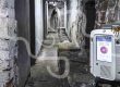
Historic Building Survey
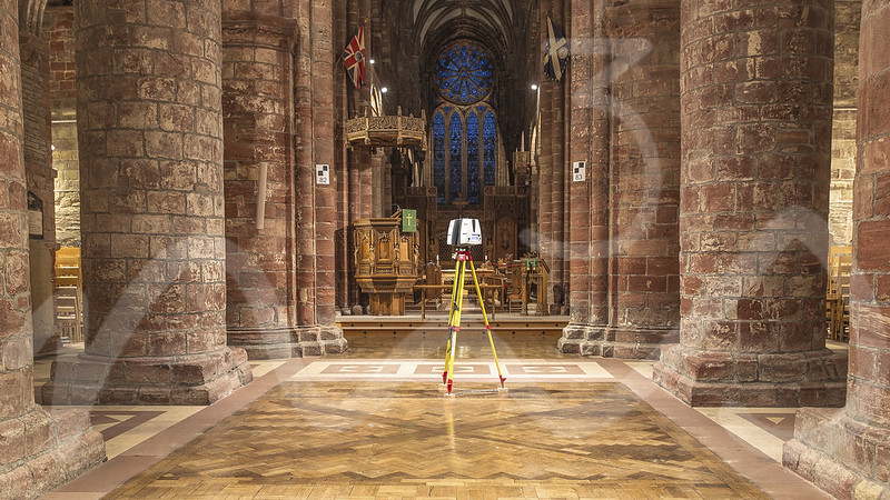
Laser scanning measured survey of historical sites
M3S Surveys Ltd – Measured Surveys In Poland, CAD, REVIT, Surveying and Photogrammetry Services:
Terrestrial Laser Scanning (TLS) – https://www.m3s-surveys.com/services/terrestrial-laser-scanning/
Building Surveys (MBS) – https://www.m3s-surveys.com/services/measured-building-surveys/
Topographic Surveys – https://www.m3s-surveys.com/services/topographic-surveys/
Photogrammetry – https://www.m3s-surveys.com/services/photogrammetry/
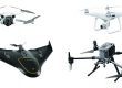
Aerial Surveys – https://www.m3s-surveys.com/services/aerial-surveys/
Spatial Data Analysis & Processing – https://www.m3s-surveys.com/services/spatial-data-analysis-processing/
Links:
3D Revit Model – https://www.autodesk.co.uk/products/revit/overview?plc=RVT&term=1-YEAR&support=ADVANCED&quantity=1
Leica P40 Laser Scanner – https://leica-geosystems.com/en-gb/products/laser-scanners/scanners/leica-scanstation-p40–p30
Leica RTC360 Laser Scanner – https://leica-geosystems.com/products/laser-scanners/scanners/leica-rtc360
Capturing Reality (Photogrammetry) – https://www.capturingreality.com/
2D Cad Drawing – https://www.autodesk.co.uk/products/autocad/overview?plc=ACDIST&term=1-YEAR&support=ADVANCED&quantity=1
M3S Surveys Measured Surveys In Poland & Surveying Services Social Media Channels