The new Leica file format, LGS & JetStream Viewer has really impressed not only our staff but clients – primarily the offline viewing option for LGS within the JetStream Viewer (now replaced by TruView app for PC) This allows anyone to view the scan stations and “fly” through the point cloud smoothly with out the need for a high spec pc.
The M3S Surveys team have been enjoying the recent upgrades in Leica Cyclone Register & Publisher Pro 2020.1 – including the LGS export for viewing within JetStream. The latest release allows users of the FREE Jetstream Viewer to import models in IFC and OBJ formats to view them against the point cloud. An example of this can be seen in the following video from the Reality Capture expert, Paul Burrows of Leica Geosystems in the UK:
M3S Surveys Ltd – Laser Scanning, CAD, REVIT, Surveying and Photogrammetry Services:
Terrestrial Laser Scanning (TLS) – https://www.m3s-surveys.com/services/terrestrial-laser-scanning/
Building Surveys (MBS) – https://www.m3s-surveys.com/services/measured-building-surveys/
Topographic Surveys – https://www.m3s-surveys.com/services/topographic-surveys/
Photogrammetry – https://www.m3s-surveys.com/services/photogrammetry/
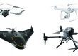
Aerial Surveys – https://www.m3s-surveys.com/services/aerial-surveys/
Spatial Data Analysis & Processing – https://www.m3s-surveys.com/services/spatial-data-analysis-processing/
Links:
3D Revit Model – https://www.autodesk.co.uk/products/revit/overview?plc=RVT&term=1-YEAR&support=ADVANCED&quantity=1
Leica P40 Laser Scanner – https://leica-geosystems.com/en-gb/products/laser-scanners/scanners/leica-scanstation-p40–p30
Leica RTC360 Laser Scanner – https://leica-geosystems.com/products/laser-scanners/scanners/leica-rtc360
Capturing Reality (Photogrammetry) – https://www.capturingreality.com/
2D Cad Drawing – https://www.autodesk.co.uk/products/autocad/overview?plc=ACDIST&term=1-YEAR&support=ADVANCED&quantity=1