Survey For Renovation Projects – Engineers, Planning Consultant, Interior Designer, Quantity Surveyor & Architect
Over the last year the M3S Surveys Ltd team have been involved in several Survey For Renovation Projects – Engineers, Planning Consultant, Interior Designer, Quantity Surveyor & Architect. The majority of the sites have been large homes and outbuildings, all in various different conditions and states of repair. Using a wide range of the latest technologies including laser scanners, total station, GNSS, cameras and UAV we are able to capture the as built conditions on site. This allows the team to then create a range products the client can use themself, share with their engineer, planning consultant, architect and interior designer. Our Survey For Renovation Projects – Engineers, Planning Consultant, Interior Designer, Quantity Surveyor & Architect , allow the data to be captured safely and quickly on site with the various products being delivered and shared with various professional services. The LGS TruView has continued to prove very popular allowing anyone with a PC to install free to use software called Leica JetStream Viewer. This software then allows the LGS file to be attached and you can navigate through each scan station and take measurements and mark up areas.

Survey For Renovation Projects – Services & Products
Laser Scanning – fast, accurate collection of all the visible points that is registered together to create a point cloud of your project.
Photography – we can capture standard high resolution imagery and a range of 360 images depending on the job specification.
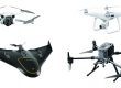
UAV Photography – our partners in the UK & Poland are fully liscenced and insured to fly. The M3S team have years of experience on UAV projects including flying fixed wing and processing data.
Photogrammetry – the imagery captured with the UAV and terrestrial photography can be merged in specialist software and combined with laser scan data and/or points surveyed using a total station for scale to produce high resolution ortho photos and models.
Land Surveying – survey control and topographical data captured.
2D & 3D Drawings – supply both 2D and 3D drawings and topos.
3D Revit Model – 3D model of as built conditions in various formats including Revit.
M3S Surveys Ltd – Laser Scanning, CAD, REVIT, Surveying and Photogrammetry Services:
Terrestrial Laser Scanning (TLS) – https://www.m3s-surveys.com/services/terrestrial-laser-scanning/
Building Surveys (MBS) – https://www.m3s-surveys.com/services/measured-building-surveys/
Topographic Surveys – https://www.m3s-surveys.com/services/topographic-surveys/
Photogrammetry – https://www.m3s-surveys.com/services/photogrammetry/
Aerial Surveys – https://www.m3s-surveys.com/services/aerial-surveys/
Spatial Data Analysis & Processing – https://www.m3s-surveys.com/services/spatial-data-analysis-processing/
Links:
3D Revit Model – https://www.autodesk.co.uk/products/revit/overview?plc=RVT&term=1-YEAR&support=ADVANCED&quantity=1
Leica P40 Laser Scanner – https://leica-geosystems.com/en-gb/products/laser-scanners/scanners/leica-scanstation-p40–p30
Leica RTC360 Laser Scanner – https://leica-geosystems.com/products/laser-scanners/scanners/leica-rtc360
Capturing Reality (Photogrammetry) – https://www.capturingreality.com/
2D Cad Drawing – https://www.autodesk.co.uk/products/autocad/overview?plc=ACDIST&term=1-YEAR&support=ADVANCED&quantity=1